A drone can reach a surface that is difficult for an inspector to approach, but access alone does not produce a defensible condition assessment. Images must cover the relevant components, retain enough detail and connect to an identifiable location. Someone must then interpret what they show. That distinction is central to evaluating automated capture for infrastructure inspection.
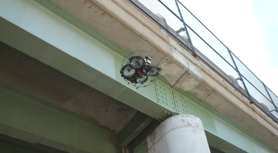
Flyability’s case study describes Gedeon GRC using the Elios 3 on bridge components above a freeway. The team combined an initial inspection and mapping workflow with AutoScan’s systematic image capture. Engineering, drone operations and BIM/VDC specialists participated, with the resulting imagery evaluated for documentation and future Scan-to-BIM work. The source describes an evaluation, not a certified autonomous inspection or a completed production building-information model. An exact publication date was not established from the source. Primary source.
Define the deliverable before planning the flight
An inspection image and a modeling image can serve different purposes. An engineer may need a close view of a joint, while a reconstruction workflow needs overlapping views that connect reliably across a larger surface. A flight that satisfies one requirement may leave gaps in the other. An effective plan should identify both requirements and the circumstances in which separate capture is necessary.
For example, an inspector might need to understand whether an apparent mark continues behind a connection. A smooth three-dimensional surface model could conceal that uncertainty if the underlying view is incomplete. The deliverable should expose missing observations rather than encourage a reviewer to assume that a visually coherent model represents complete evidence. This is a hypothetical evaluation scenario, not a reported failure in the case study.
The inspection specification should also identify which components require another method. A camera record cannot automatically answer every question about material condition. Combining observations can be useful, but the record needs to preserve which instrument produced each result and what that result can support. A shared coordinate system helps organize evidence; it does not make different measurements interchangeable.
Capture consistency needs its own quality checks
Automating a path can make image spacing more repeatable, yet the useful output still depends on the scene and capture conditions. Occlusion, surface texture, illumination and motion can affect the evidence available to downstream reviewers. A quality gate should examine the resulting data rather than infer quality from successful completion of the flight plan.
The field team should be able to identify incomplete areas while a repeat visit is still practical. Discovering a missing view only after access arrangements have ended can erase some of the efficiency gained during collection. This suggests a useful division of responsibility: automated capture handles a repeatable task, while a defined review checks whether the intended information was actually obtained.
A documented coverage map would help the engineering team distinguish inspected surfaces from inferred geometry and areas outside the assignment. It should remain possible to navigate from a model location to the supporting original images. If processing changes a measurement or removes an apparent feature, the earlier version and the reason for the change should remain understandable.
A repeat survey is a comparison problem
Infrastructure owners may eventually want to compare conditions over time. Repeating a route is helpful, but meaningful comparison also requires attention to reference frames, capture settings and processing versions. A difference in the resulting model may reflect a changed structure, changed visibility or a changed reconstruction process. Treating every difference as deterioration would create unnecessary follow-up work.
An evaluation could therefore include a repeat capture of an unchanged area. That would help establish the variability of the workflow before it is used to interpret change. The purpose would be to understand uncertainty, not to manufacture a single accuracy number that appears to cover every surface and operating condition.
The handoff should include the original evidence, processing history, unresolved gaps and the identity of the person responsible for interpretation. These items make the dataset reusable without requiring future staff to reconstruct the assumptions of the original field team. They also make it easier to decide when a later question requires new information rather than another pass through existing imagery.
Flyability’s example is useful because it connects capture to the teams that consume the data. Its significance is the possibility of a more coordinated inspection record, rather than proof that engineering judgment has been automated. The next convincing evidence would show accepted deliverables, the work required to produce them and the limitations that remained after review.
References
Questions, news tips or corrections? Contact [email protected].